Spatial Variation of Geothermal Heat Flux in the McMurdo Dry Valleys, Antarctica
Ricardo Garza-Giron, Slawek Tulaczyk, Denys Grombacher, Nikolaj Foged, Peter T. Doran, Neil Foley, Jill Mikucki, Hilary A. Dugan, Krista Myers, Esben Auken, Ross A. Virginia, Thue Bording
WORK IN PROGRESS
Geothermal heat flux (GHF) in Earth's crust is one of the most unknown geophysical parameters in Antarctica.
GHF in polar regions is of great importance to understand its effect in the thickness of permafrost, the nature of hydrological systems in these areas and to have an estimation of its influence in ice-sheet and glacier's flow.
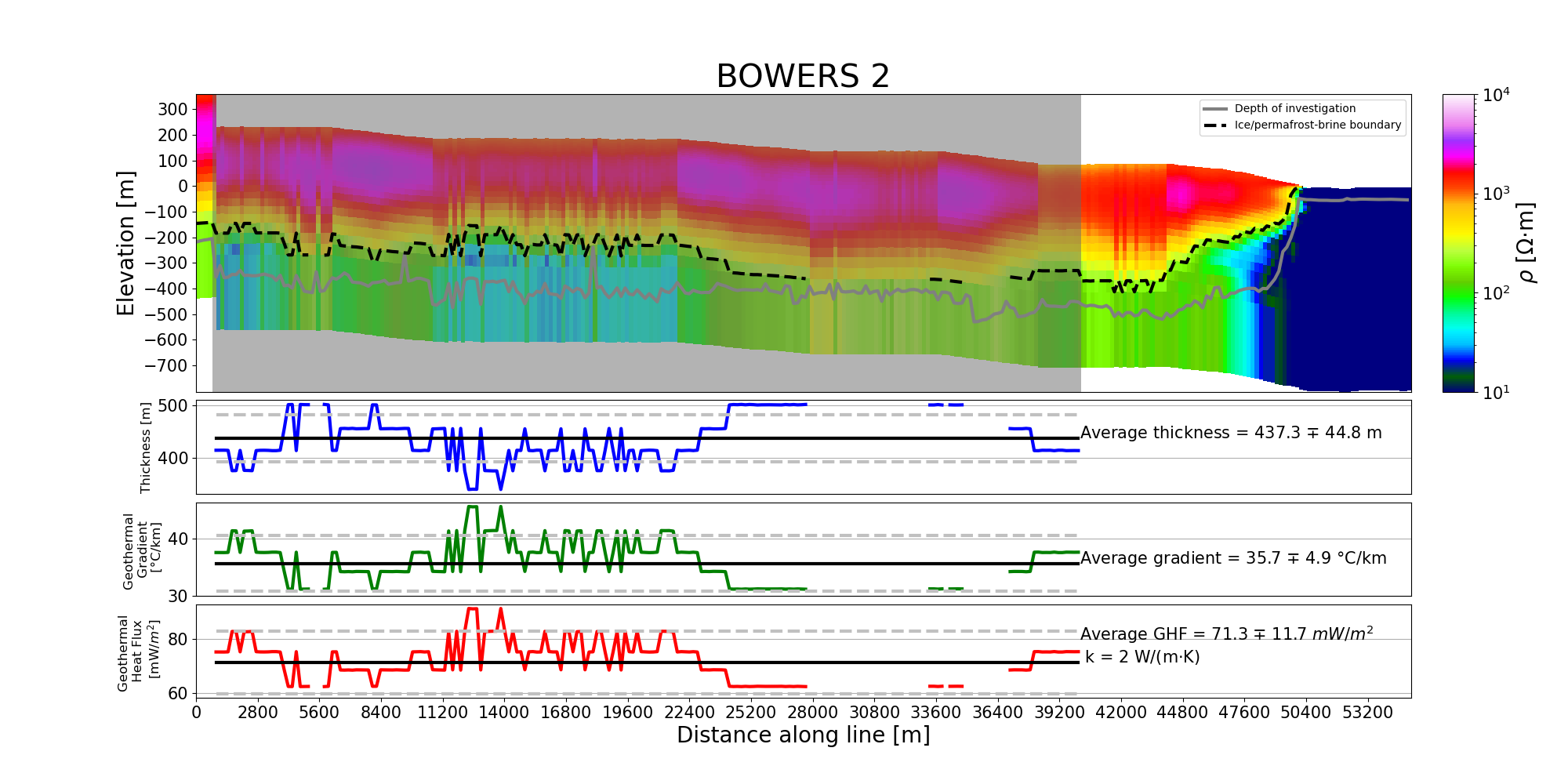
Antarctica's remote location and its huge layers of ice and hard permafrost makes it very difficult to access to make in-situ measurements of GHF by drilling into the Earth, so measurement of GHF are very scarce. In this work, we use the data of an Airborne Transient Electromagnetic survey from 2018 to make indirect measurements of the thickness of permafrost in the McMurdo Dry Valleys region to constrain measurements of GHF.
Geothermal heat flux is mathematically described by the equation:
q = k*(dT/dZ)
Where:
q = GHF
k = thermal conductivity
dT = temperature difference
dZ= thickness
This non-invasive method survey yielded thousands of kilometers of flight lines from which we can obtain geoelectric images (i.e. we can see how resistive or conductive the subsurface is). Ice and permafrost are usually resistive materials, whereas water and brines are conductive. Assuming the resistivity value of brines, we developed a method that automatically finds the boundary between permafros/ice and their underlying liquids, this solves our dZ part of the equation. We are currently working on using climate models-based temperature data that we will be able to use to determine the temperature at the surface in different parts of the region, and by assuming the temperature at which brines are liquid under the permafrost we can get dT. Lastly, we can make an attempt to calculate a bulk thermal conductivity of different parts of the region by getting estimates of porosity from the same geoelectric images (using Archie's law) and assume that most of the pores in the permafrost are filled with ice.